OPEN-AIR MUSEUM
„MURTERS SPECTACLE“
Client: Šibenik-Knin County Development Agency
Produced by: Invictus consulting d.o.o.
Authors: Jelena Devčić and Valentino Dražić Celić
Šibenik, November 2021
1.a.1. „MURTERS SPECTACLE“ – GRAPHIC LEGEND
Open-air museum „Murters spectacle“
After last night’s rain
with bora tonight they swam
the islands, Kornati rocks
stopped in the morning sun
just outside our door
– T. Cukrov, „After rain“
Murter, this unusual jewel in the sea adorned with numerous islands linked by karst and blessed with islanders’ resilience, has been building its history for thousands of years. From prehistoric times, when the sovereign rulers of the Adriatic Liburnians built their port city of Colentum here, to the ancient times, when Colentum was settled by the Romans, to this day one can trace the continuity of the population of the island of Murter. The sea has always shaped the history of the island. It provided life potential and protection, while limiting and shaping the life habits of the islanders. Take a walk with us through the history and heritage of Murter and discover the most beautiful views of the island “captured” in the frame.
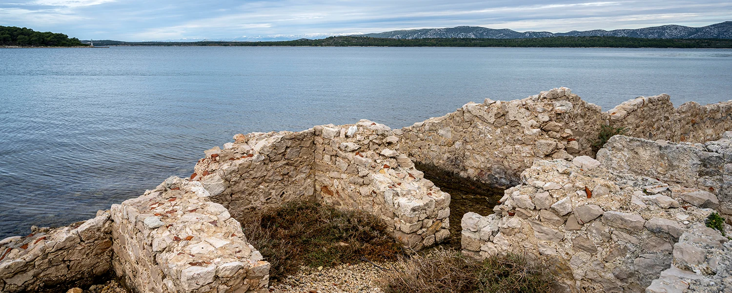
1.c.1. COLENTUM – GRAPHIC LEGEND
Ancient port of Colentum
If we were to return in time, in the 1st century BC, to this place and look towards the sea, the view would be much different. We would see the very busy ancient port of Colentum and the settlement that developed around it. The port of ancient Colentum was located on the northwest side of the Gradina peninsula. It was located in a very sheltered bay, closed on one side by the Gradina peninsula and on the other by the islands of Mali and Veli Vinik and Tegina. It is believed that the period of the 1st century BC is the time of its strongest traffic activity.
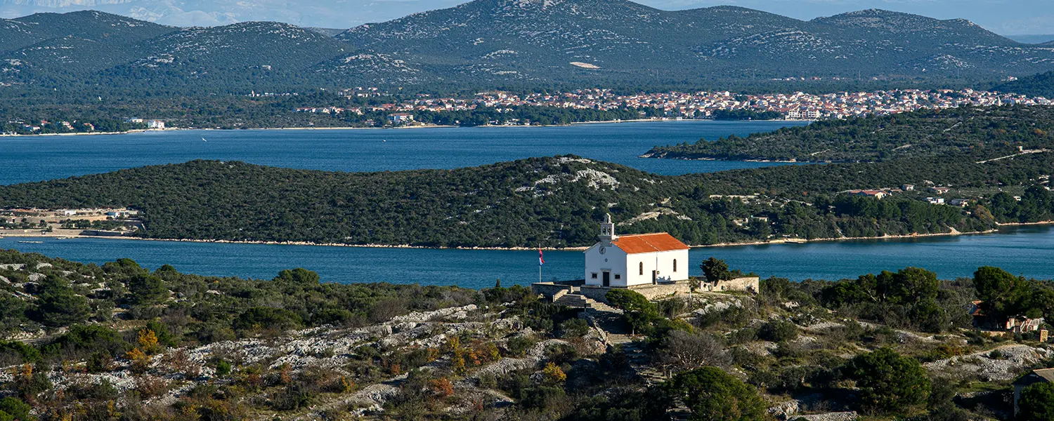
1.e.1. MURTER WATER AREA – GRAPHIC LEGEND
Murter water area
Authentic Mediterranean filigree, consisting of the sea and islands rising like pearls from the blue, is visible in Murter along the entire coast. Namely, the municipality of Murter-Kornati is blessed with over 160 islands and nearly 400 kilometers of coastline, making it the most indented municipality in the entire Mediterranean.
Among the Murter islands, the Kornati archipelago is particularly important, which is protected and declared a National Park. Also worth mentioning is the Žut – Sita archipelago, parts of which have been declared a protected natural area. All these pearls of Murter are washed by the whimsical Murter Sea, a sea area of 210 square kilometers, bounded by the mainland, the Kornati islands and the Šibenik islands of Kaprije and Žirje. This sea area is exposed to strong winds and sudden wind changes and strong ocean currents, so sailors must always be vigilant in its waters.
1.f.1. MODRAVE – GRAPHIC LEGEND
Modrave
Olives have been cultivated in the Murter region since ancient times. Roman sources say that the best olive oil comes from Liburnia, from the area of the former Liburnian cities, including Colentum, today’s Murter.
The first written information about the existence of olive groves in the Murter area dates back to 1386. With the population growth of the island of Murter, there was a need to expand property to overseas territories, especially the Kornati and Modrave.
With the arrival of people from Murter in Modrave in the 17th century, one of the largest olive groves in the Mediterranean began to appear, occupying an area by the sea about 11 kilometers long and up to three kilometers wide.
The biggest step in the development of olive growing on the island of Murter was the construction of a local oil mill. According to tradition, this complex was built by Franz Joseph I, heir to the Austro-Hungarian throne. According to the legend, the heir to the throne found shelter in one of the Kornati bays during the storm, and then ended up as a guest of the Murter people. This unusual traveler, whose identity the people of Murter did not recognize, was served a meal seasoned with olive oil. Murter’s “liquid gold” and the hospitality of the islanders delighted the heir to the throne so much that he financed in 1910 the construction of a state-of-the-art oil mill. Modrava olive oil has always been of high quality. It was served at the table of the imperial court in Vienna, and numerous recognitions and awards came from various world festivals as a confirmation of its quality.
Both then and now, olive growing is the most developed agricultural branch in Murter – Kornati municipality, and Modrava oil has become a symbol of investments in olive growing with the aim of creating prosperity in the island area.
BULLET: Venetian shipowners regularly bought the esteemed island oil from Murter people. A historical record gives information about the purchase of 124 barrels of oil and 520 pieces of cheese.
BULLET: The importance of olive oil as a food throughout history is evidenced by Napoleon’s decree that every man must plant a hundred olive trees before marriage.
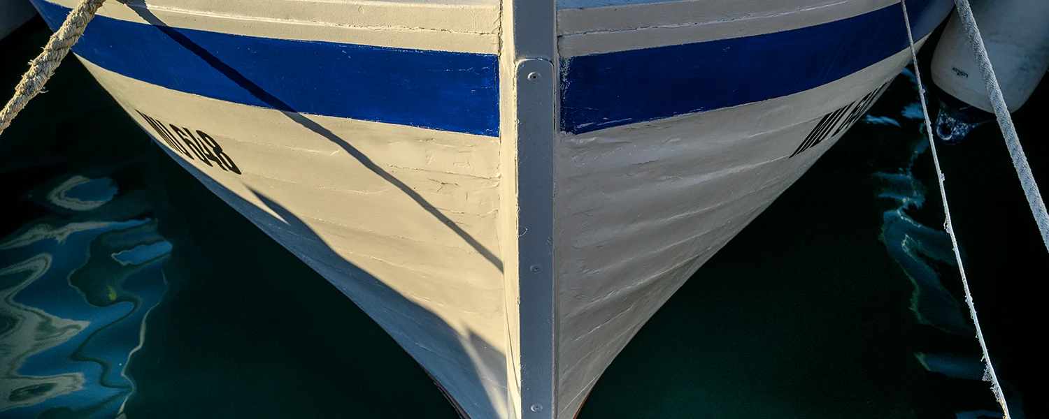
1.g.1. SHIPBUILDING – GRAPHIC LEGEND
Traditional wooden shipbuilding
Overseas estates on the Kornati and Modrave forced the people of Murter to change their way of life. They had to master naval skills and knowledge, but also build an island fleet.
Besides the country estates, the ship was also used for trips to the city centers of Šibenik and Zadar, where administrative work was done, crops were sold or supplies were bought. Because of this way of life, the boat has become an indispensable part of every household. Murter ships were first built by shipbuilders from Šibenik. However, in the middle of the 18th century, the shipbuilding family Filipi came from Korčula to Betina and opened the first shipyard on the island. These first Betina shipbuilders, along with the Uroda shipbuilding family, developed a solid staff of craftsmen to build all types of medium and small size ships. Betina became the center of wooden shipbuilding, and its shipbuilders supplied wooden ships to the entire area of northern Dalmatia. The shipbuilding tradition on the island of Murter is still preserved today. Murter itself has several famous shipyards specializing in wooden shipbuilding, but the most famous for its art of shipbuilding is still Betina.
1.h.1. MURTER – BETINA FIELD – GRAPHIC LEGEND
Murter – Betina field
The inhabitants of the island of Murter have been farmers, agriculturists, and stockbreeders since the beginning of the formation of the settlement in the 14th and 15th centuries. The majority of the island’s agricultural activities took place on the Murter-Betina plain in the northeastern part of the island. This unusual morphological element, which is usually found only in mainland areas, has historically been the main source of food for the inhabitants of Murter. The limestone plateau filled with a thicker layer of red soil has always been suitable for growing vegetable crops and vines. Also, the abundance of water in the field area has enabled the development of vegetable crops in the dry part of the year.
The agricultural activities of the island of Murter can be traced through concession agreements over lands in the Murter-Betina field, which date back to the 15th century. At that time, the Šibenik commune allotted land in the fields to the Linjičić, Mihetić and Simeonić families, and for these lands they paid the Šibenik chamber a teratik of a symbolic amount of ‘4 solda po gonjaju’ (amount of money paid per land unit). This most fertile zone of the island of Murter has been maximally agrarian valued throughout history, while the remaining area is mostly covered with macchia due to lack of fertile land. Although the islanders expanded their possessions to the neighboring islands due to need, the Murter-Betina field is still a symbol of the survival of this area through the centuries.
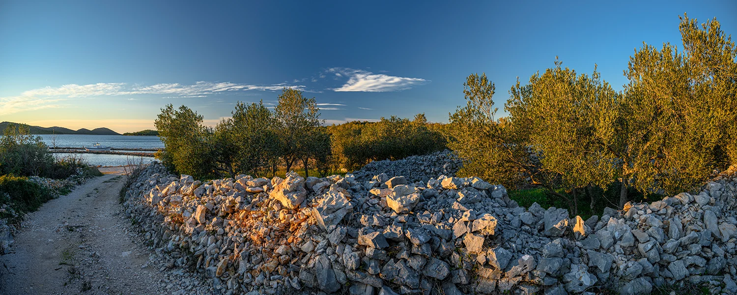
1.j.1. 7 HILLS – GRAPHIC LEGEND
Seven Murter hills
Seven Murter hills: Raduč, Gradina, Veli vrh, Mali i Veliki Vršak, Vršina and Crnikovac are the centuries-old guardians of Murter. They watch over the settlement located in the safety of a bay enclosed by hills. At the top of the hill Vršina above the center of Murter from the 18th century, travelers are greeted by the church of St. Roko. This church was built in 1760. The people of Murter raised it in a vow to the saint who saved them from the plague.
On the Rauduč hill during the Kingdom of Yugoslavia, the construction of a military complex began, consisting of a command building, a reconnaissance tower, several smaller buildings and a tunnel system with three entrances. The tunnels, which were drilled into the living rock with dynamite and large hammers in the 1930s, end with two coastal artillery battalions, a machine gun nest, a reconnaissance and a semicircular defense trench.
The Liburnian and Roman settlements of Colentum were scattered on the Gradina hill on which this educational trail is located. Remains of Roman and Liburnian walls, plaster and roof bricks can still be seen at the very top of Gradina hill. Although unexplored, all these findings, as well as the statements of researchers, point to the existence of an acropolis at this place. Today, the top of Gradina can be reached by a fairly well-maintained goat trail, and there is a cross at the very top.
1.l.1. KORNATI – GRAFIC LEGEND
Kornati
The main part of the Murter archipelago is the Kornati archipelago – a stone labyrinth with 89 islands, islets and cliffs, a natural phenomenon that has been declared a National Park due to its exceptional beauty. The Kornati islands are entirely private property. Ninety percent of the owners are residents of the island of Murter. At the end of the 19th century, these Dalmatian peasants bought the islands from the nobles and fenced their estates with dry stone walls. There are about 260 kilometers of dry-stone walls on the island of Kornat alone, and an impressive 330 kilometers in the entire area of the National Park.
Life on the Kornati has always been a struggle for survival. Man’s perseverance in survival changed the appearance of the island. Today’s island barrness dotted only with “green oases” of vegetation is not, in fact, a picture from antiquity. The sparse greenery in the rocky pastures fed the sheep, and the millennial exploitation of these areas resulted in deforestation and turning the island into bare rock.
The view of the Kornati is perhaps most impressive on the offshore side of the island, where cliffs rise up to 80 meters above the sea. However, the horizontal layers of some islands, such as Malo Šilo, are no less impressive. The layers give the impression of neatly arranged stone stairs that “climb” to the top of the island.
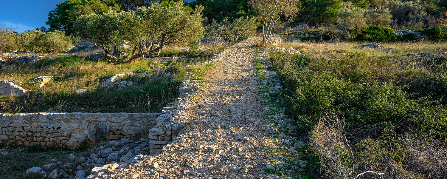
1.m.1. ROMAN ROAD – GRAPHIC LEGEND
Roman road
The finding of a city street is important for the urbanism of Colentum. The route of this street is located below this place and is clearly visible even today. It was laid south of the fence of the cemetery of Our Lady of Gradina. The two main buildings were built south and north of the street, and the entrance to them was through a courtyard enclosed on the street side by a high wall. These buildings, in addition to the ground floor rooms, also had rooms upstairs. Fresco fragments were found in the buildings. The only better-preserved mosaics were found in the northern building.
It is assumed that these mosaics date back to earlier centuries and are probably the product of a school / workshop centered in Salona. Based on the dating of the finds of ceramic pottery, it was concluded that the building was built in the time of Augustus and that it lived continuously until the first half of the 2nd century, when changes occurred. According to archaeologists, the houses were destroyed in the earthquake. This was followed by the reconstruction of the settlement, primarily in the coastal part, while the higher parts of Gradina were probably neglected, only to be repopulated in late antiquity and the Middle Ages.